Sunday, October 15, 2017

Wyoming to Medicine Bow National Forest

There are two reasons why this blog is so slow this week: first, I cannot seem to catch a good signal.  I completely finished this posting when, suddenly, a message came up showing I had no wifi connection.  The next morning the entire posting I had worked on was gone.  GRRR!
Second, I hate to do a posting twice.  I am never as creative the second time around. So, Sorry.


This summer I have been trailing behind Tony and Karen. Their blog called "Rolling in a RV-Wheelchair" is over there on the right of this page and has been a wealth of ideas and insight for me.
  The drive through Wyoming was so boring I decided to check out their blog to see if they could inspire me with something of more interest than sagebrush and semi-trailer trucks. 

Well, it seems they were bored with the drive as well and opted to leave the freeway at about Walcott and head for the Snowy Range in Medicine Bow National Forest.  Of course the weather was quite a bit warmer when they headed up into the mountains but I was willing to gamble that the weather would hold for me too.  Anything to get away from the roar of the trucks on the freeway.


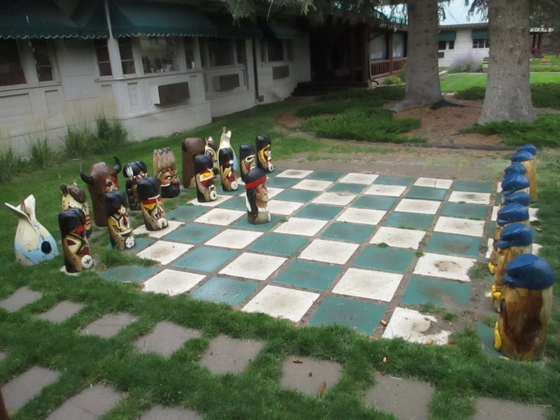
Once again I used the RV Golf Club free night stay at this delightful little resort in Saratoga.  They have the usual golf course, plus cabins, bar, restaurant, this cute outdoor chess game, and a pool fed by a natural hot spring.  I was all ready to spend an evening luxuriating in a hot pool but could not find my bathing suit.  I had packed it away somewhere and boy did I look for it--but no luck.  I was afraid that if I improvised with something like cut-off jeans I might get tossed out--so I skipped the spa.  


But, I am finding that bathing suit before another opportunity presents itself.


The next town on the road to  the Snowy Range and Medicine Bow was Encampment.  Just as I drove into the town I was met by a herd of steers.


And Daisy went ballistic jumping from window to window and barking her annoyance at those big dogs.


Now I was beginning to enjoy Wyoming.  


ENCAMPMENT, WYOMING
(Grand Encampment)
Elevation: 7,323 ft
Population 450

Once a favorite hunting ground of Prehistoric man, later 'Camp le Grand' became a noted rendezvous of indians and trappers.  
In 1897 mining began and in 1902, during the mining boom, the longest aerial tramway in the world was built to convey ore 16 miles from the great Ferris-Haggarty mine to the smelter at Encampment.  In 1908 the mining industry collapsed.


There is a wonderful museum that includes many of the old homes and buildings from the more prosperous days.


While I wandered around I noticed there was a person up in the tower watching for wild fires I presume.  He never once stopped scanning the horizon and I realized how critical that job has become.


STAGECOACH WAY STATION

The station was located on Lake creek at its confluence with the North Platte River.  Built in the 1870s it was used as a way station for the U.S. Cavalry stationed at Ft. Steele.


The absolutely best part of this town is that it provides free parking for RVs with a dump station that asks only for donations.  Now, how welcoming is that?


The weather was turning threatening and I wasn't sure I had made a good choice to drive over the Snowy Range.   It was a long way to turn around and go back to the freeway though and besides, I was starting to see lots of antelope.


This little guy convinced me to tackle the mountain pass.  I would just not spend the night in the mountains but continue on to Laramie.


Not only was the temperature dropping but the trees were broadcasting autumn.


We climbed another 1000 feet and I started to wonder where I had stashed my jacket.  Probably the same place as the bathing suit.


Boy, was she puzzled.  


Where's the grass?


There were some snow flurries but the road stayed free of ice.  I am sure, however, that I needed to be down from there before nightfall.


The sky was as breathtaking as the mountains.


 This is NOT a black and white photo.


Nor is this one, taken at the very top.  


I am very glad I ventured off the freeway.  This was a wonderful diversion.


Thank you, Karen and Tony for the inspiration.

Wednesday, October 11, 2017

Salt Lake City to Wyoming--Contrasts.


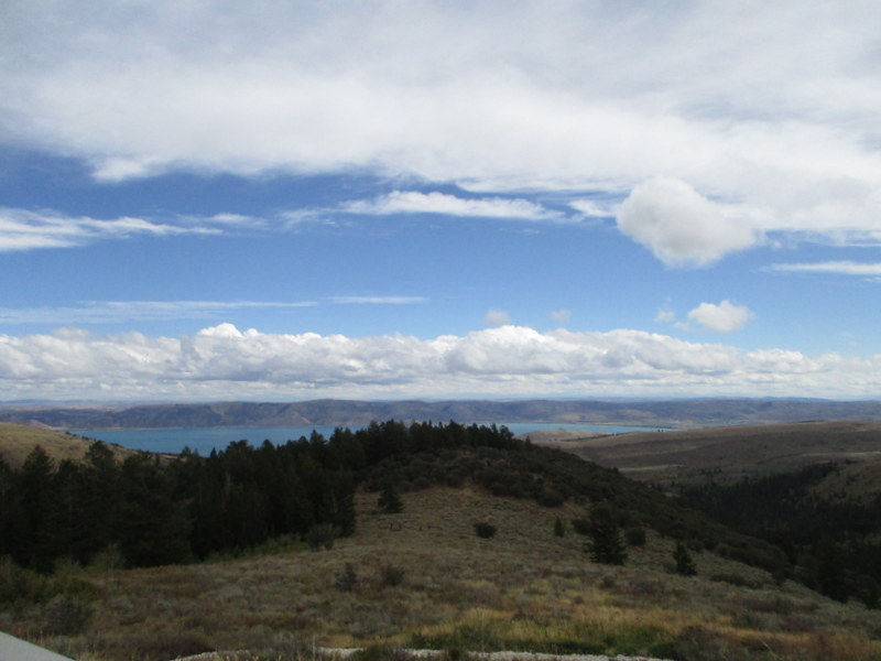
If you look on a map of Utah, in the most Northern part of the State, you will see a small lake that extends across the state line into Idaho.  Bear Lake and the tiny towns along its shore are about as far off the major highways as one can get without hiking.


I reached this interesting area by traveling a very narrow and winding, but scenic, drive through Logan canyon west of the town of Logan, Utah.


The lake is quite high in altitude and is as picturesque as any one could wish for.


There was still a hint of smoke in the air but it just made the scenery look ethereal.


Bear Lake and the Logan Canyon historically provided food and shelter to the Shoshone Indians.  Today it is a somewhat remote recreation area that is still mostly natural.  For a while the canyon became a mining area but returned to its more natural state when the mining petered out.


"Four species of fish are found in Bear Lake and nowhere else in the world.  Isolated geographically for at least 100,000 years has resulted in the evolution of four species of fish that have adapted to the unique Bear Lake environment.


The BONNEVILLE WHITEFISH


The BEARLAKE SCULPIN


The BONNEVILLE CISCO


The BEARLAKE WHITEFISH 


 The weather was turning cold (something I welcomed after so much heat) and I spied snow capped peaks coming up in my travels.


Daisy welcomed her new warm covers. 

In very short order I was in Wyoming and the change of scenery was striking. It is no wonder why the  Mormons and other early pioneers pushed on to Utah where water was more plentiful.


"This marker on the Overland Trail, Platte River Crossing , Nine Miles West, 1861 to 1868.'


An Interstate Highway circa 1860.


The wind and rain were becoming fierce so I found a spot near a truck parking area and got far enough away that the constantly running motors would not disturb my sleep.


 The next morning I woke to rumbling, raised my shade and saw this.  I was completely engulfed by semis, so close to me the diesel odors competed with my morning bacon and eggs.  UGH!


I did not hesitate to get back on the road though the weather was definitely ominous.

Thursday, October 5, 2017

Reno to Salt Lake City


 This log is a portion of a redwood tree which contained 45,000 board feet of lumber.  This tree drifted onto the Crescent City, California beach during the 1964 flood.  The log is 1477 years old  (540 CE) and was cut from the largest piece of driftwood ever collected.  


It was presented to the city of Winnemucca as an appropriate marker for the beginning of the 'Winnemucca to the Sea Highway'.


Lots and lots of nothing....


...with occasional bits of something. 


The Victory Highway is a near-forgotten relic of the early 20th century roadways, a path traversed by early auto-pioneers from the Atlantic to the Pacific Oceans. 


 The road was completed and dedicated in 1925 and used until the 1940s.  


I can only imagine driving across country on the Lincoln Highway.  It was improved and straightened out a little, then renamed the Victory Highway.  In the 1950s it was replaced by Interstate 80.


 In 1912 roads were dirt, bumpy and dusty in dry weather, impassable in wet weather.  The Lincoln Highway was the first improved automobile road across the U.S.  It ran from Time Square in New York City to Lincoln Park in San Francisco, traversing 14 states.

 As an 'improved road' it was graded and topped with gravel. 


As the first automobile road across America, the Lincoln Highway brought great prosperity to hundreds of cities and towns along the way.  The original length was 3,389 miles.  


Lake Bonneville was a large ancient lake that existed from 32,000 to 14,000 years ago.  For thousands of years, ancient Lake Bonneville was contained by mountains acting as natural dams.  The largest area covered by the lake was more than 20,000 square miles, and with depths of just over 1000 feet, 

 
The lake was freshwater, with its source from rainwater and melting glaciers.  


As the lake expanded in size it gradually spread over much of Utah and into Nevada and Idaho.


Approximately 14,500 years ago, the lake broke through a natural earthen dam and spilled into the Snake River in Southeast Idaho, discharging an immense volume of water.  The once great lake retreated into what is today, the Great Salt Lake located next to the city in Utah which bears its name.


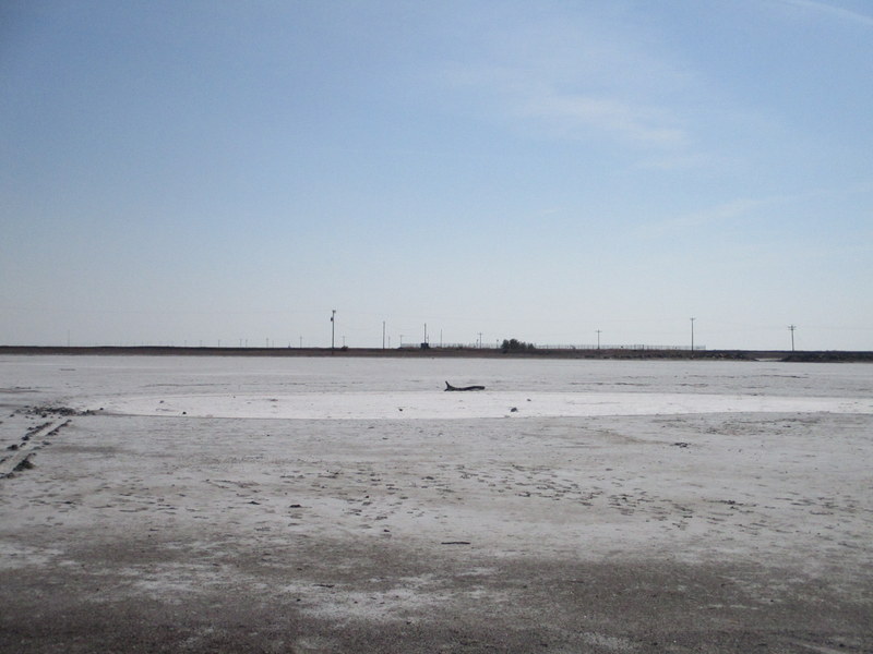
The Bonneville Salt Flats or the Great Salt Lake Desert was established when Lake Bonneville emptied and evaporated and left behind a vast concentration of salt and minerals.  The composition of minerals ranges in thickness from one inch to six feet.  


The Salt Flats are one of the flattest areas on earth.  The Flats cover 3,000 square miles and are larger than any other salt bed, worldwide.  Sunlight and heat rise from the blinding-white surface creating images and mirages.


The purest salt is hard as concrete when dry and makes the world's best racing surface. Known as the greatest speedway in the world, it has been used to set records of speed and endurance.
In 1970, Gary Gabelich, in the Blue Flame Jet-powered rocket car, produced a top speed of 622.40 MPH, a speed that stands as the fastest documented time on Bonneville.


Spirit, Daisy and I chugged our way down the road at 58 MPH--but we can reach 75 on a downhill run with a tailwind.


 That night we parked at a casino in Wendover, Nevada and this vehicle pulled in next to us.  (This photo is for you, Glenn.  I didn't get a chance to meet him but I suspect his outlook on life is similar to yours.)


'Wendover Will"


 The weather was starting to change--rain, wind and colder at night. 


Leaves were changing colors...


...and this was the most sun I saw for several days.  I still had a lot of driving to do before heading south--I felt an urgency to keep moving.